Tuesday, May 26, 2020

Dagirls have Landed

Date May 26th
DaGirls Landed on the evening of May 24th at Dana and Michael' s place in Saint Charles. Specifically where? At an unnamed location.

Stay - well unknown for now. Attempt for 1 month in the driveway.
Power - none -
Water - when needed
Dump - none, unless we leave and come back

Grand-children - don't care - electronic stuff and other things
Daughter & Son in law - Excited like real children - Why? Adults discussion and play-time

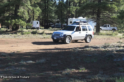
Photos of area


Photos along the way - not the best 


Special News Stories ? Still thinking and working on them.


Susan, Tilly, Dakota 7 me.
Safe Travels and Journeys 
DaGirls Rv

Saturday, May 23, 2020

Stop-Over in St. Louis

Well, or at least close to St. Louis. We'll be stopping for the night in Florissant, Mo. for the night at the Elk's lodge. This will allow us to see Susan's brother and sister-in-law.

Last night we spent a night at the Elk's lodge in Springfield. Guess what? 50 amps and dinner. Also music in the parking lot in front. This also allowed us a 1.5 mile walk thru the neighborhood.

As always, Elk's are great place to stop, if it is allowed.  Below are photos of the Wooly burger we purchased. Enough for 2 people, 2 dogs for 2 days.


So, what have we seen. Well today we saw a graveyard for boats wrapped in condoms.


Ok, so let's talk dinner or lunch while driving.
Oh, sure you comment, you just stop and go into a fast-food-joint.
Not DaGirls, this morning, Susan made me pancakes, while I drove. Then I found a suitable place, I pulled over, walk the puppies, and then Susan drove. Then while she drove, I had some pancakes. Yum.

Course these were left-over pancakes from the freezer, however, easily warmed up in the toaster. Toaster you say. You can't do that. Well yes we can, as there are 2 ways of doing this.
1. Generator on - which we do use while driving to cool the Rv.
2. Pure Sine Wave (PSW) , inverter, which allows up many options to cook while rolling-on.

Example: Crock-Pot, Instant-Pot ( which we do not have), making Coffee, Toaster, and Microwave (power 80 to 50%) are just a few examples.

We do love our PSW.

But we also like to pull over and smell the roses, as to what's the rush. Yes I know there are many Control-Freaks. But what's the rush, if not for yourself, do it for your Co-Pilot sitting next to you. It really makes no sense in driving 70 mph, rushing to the next destination. Either you have a place or you dry-camp for the night.

As Wayne stated "I want ti Do It All". 

So, what's it like driving during the Covid-19 pandemic? Well, not much has changed. What do you mean? Well, at truck stop's. Except for New Mexico, there have been no rules on wearing masks. Most employees do not, and many truckers do not.

However, some people are trying to stay the 6ft distance and not staying long next to anyone. Unless of course they travel together or know each other very well. It is one of those number's game.

Example: The average deaths in the USA is around 8000 people. This accounts for everything, except for Covid-19. As of today, 96,000 people have died due to Covid-19, since Feb. If all the deaths stopped today, that would be 264 additional lives lost per day.

All facts can be verified with the CDC website.

The biggest issue is the rate of infections and severity of infection. You can go from no symptoms, small symptoms, hospital room, ICU and then Nasogastric intubation.

So, let's all just be careful while we go outside, think of the other person.


Safe Travels and Journeys
Susan, Tilly, Dakota & me
DaGirls Travels


Friday, May 22, 2020

May 22nd - Headed to Springfield, Mo.

Wow, where did the time and miles fly away to.

You see we left Az. High Country (Coconino NF), on Wed. morning, heading east to Albuquerque. Our plan, stop at Camping Worlds (parts), Ortega Propane ($2.00 / Gal), then Elk's lodge for the night. As they say, best laid plans - and we ended up at the Elk's Lodge in Tucumcari. Lot further than planned, but a straight out drive between the 2 of us.


The lodge was closed, however, they have 4 spots @50 amp service along with water on site. So we relaxed, walk Dakota and Tilly and just enjoyed a cool evening. We arose somewhat early as is our normal thing. Planned and got ready to leave and back on the road. Also our plan was to refuel in Albuquerque, but we didn't, so now, refuel in Amarillo  , Tx.

This is the longest we have traveled between refueling stops:


Our distance from Kingman. Az., was 770 miles. Using our TSD card. Cost was $149. Not bad.

Once back on the Road, next stop was a little undecided, however with Susan driving, I located a place in El Reno, Tx. Sorry, did not take any photos, however you can read it here (Press Here ):


Cost was $20, FHU, with that, Susan did laundry - 2 loads. 

Our next plan is Springfield, Mo., with a stop in Carthage, Mo., at Colaw Rv - Press Here for Link. 

Final destination is Elk's lodge in Springfield. Now mind you, some of you may be thinking about food. Well. never fear, I found a real Hole-in-the-Wall BBQ, outside clinton.


We scored a BBQ Beef and a Wooly Burger
Wooly Burger  $10.99
Mayo, Chow Chow relish, cheddar cheese, approx 31 oz of Hickory smoked ham & 7 slices of Beef summer sausage w/a splash of Jigg's Bq sauce equals 2 lbs of FUN!!! 

BBQ Beef  $9.69 (no bun $9.39)
Succulent, fallin' apart beef brisket & Jigg’s Bq sauce. 

We finally found a Burger, that will fit Rudy's hands. Wool Burger

Ok, no recap for today, just some photos along the way:


Ok, safe Travels and Journeys
Susan, Tilly, Dakota and Me
DaGirls 


Wednesday, May 20, 2020

Travelin Day

Let's recap:
14 Days - Dry Camping in the Coconino National Forest (NF).
Generator on time: 1 Hr, due to locating under too much shade. Moved.
24/7 Inverter on.
Morning SOC, usually 73% of 800 Ahr of Lithium Battery (LB).

Many Walk-a-Bouts with Dakota. Not as many as in the pass, but she was ok with it.

Photo Ops - many.

Visitors:
Rudy & Beate, Ray & Karen, and finally Jeff & Linda.

Most exciting thing? Jeff & Linda arrived and their new Ford F150, transmission went out.

May 18 to 19, VERY windy, with gusts upto 40 mph.

Ray, must have a bad Glow plug in generator. Fixed main slide awning material. Due to wind the material was out of alignment.


Safe Travels and Journeys
Susan, Tilly, Dakota & me
DaGirls Travels 


Sunday, May 17, 2020

Finding Our Spot

So, let’s talk Dry – Camping, specifically finding places to dry Camp.

First, how do we locate a place where we can camp . I like to 3 different websites, this along with a laptop, enables a large screen to be used.

https://freecampsites.net/

http://www.ultimatecampgrounds.com/

https://www.campendium.com/

Some people my ask why not use certain Apps. Well most of them will charge you a yearly fee, whereas the above websites are FREE, and FREE is Good.

Once we have identified where we are going, we then locate a place where to explore. Next, is to locate a disconnect zone, where we leave the Rv and take our vehicle and scout the areas. Using Googles Maps (Satellite view) zoom in and search out locations to visit and check to see if the conditions are safe for our Rv.

Other references we use, especially if going to a National Forest (Not a National Park), we will go to the National Forest (NF), website.
Example: Coconino NF 
Website - https://www.fs.usda.gov/coconino/

Then if you closely look at the menu left side:


The first menu to use is the Recreation menu.


Next will be the Camping & Cabins


From there we search for location, in addition to Fire Dangers and other information.

Now for those of you who want a map, going back to the first image, you will see a menu for maps of the NF. 


When in the NF, I tend to  buy a hard copy and add to my collection, however as you can see there are Digital versions to download.

However, this is one you should get:

Printed Maps

Coconino National Forest Motor Vehicle Use Map - Free!

Cover of the 2016 Coconino NF Motor Vehicle Use MapGreat for: Driving, trail riding motorized vehicles
The Motor Vehicle Use Map (MVUM) is the legal document/map that shows where it is legal to drive a motorized vehicle. The MVUM is updated every year, so please be sure that you are using the most current version when driving on the National Forest. The newest version of the map is published and available for pick-up or download by May 1 each year.
A hard copy of this map is freely available upon request at any of our forest offices or by calling the Coconino National Forest Supervisor's Office at 928-527-3600.

Safe travels and Journeys 
Susan, Tilly, Dakota and me
DaGirls Rv


Oops almost forgot Dakota's & my Walk-A-Bout


Saturday, May 16, 2020

Woops - Title - Got Loss

Ok, here it is Sat. May 16th and time for the solar update:

Well after the small move I made, I realized, we would not be getting all the sun we needed to bring our storage system back to 100%.
So, instead of moving, I have decided just 1 hour of using the generator will bring our system back to 100%. So, 1 hour in the evening restores our system back to full.

Along the many things to do here in the High Country is the hiking trails. The longest one is the Arizona Hiking Trails System:

WHAT IS THE ARIZONA TRAIL?

The Arizona National Scenic Trail stretches 800 miles across the entire length of the state to connect deserts, mountains, forests, canyons, wilderness, history, communities and people. This non-motorized trail showcases Arizona’s diverse vegetation, wildlife and scenery, as well as unique historic and cultural sites. The route provides unparalleled opportunities for hikers, mountain bikers, equestrians and other trail users.
Starting at the U.S.-Mexico border, the path climbs and descends from one “sky island” mountain range to another, gaining and losing thousands of feet in elevation and traversing biomes ranging from desert to boreal forest. Continuing across the Sonoran Desert, the route crosses the Gila River, winds through the Superstition Mountains and the Mazatzal Wilderness on its way to the Mogollon Rim and majestic San Francisco Peaks. The trail north takes travelers across the Grand Canyon through billions of years of geology. Topping out on the North Rim, conifer forests dominate the Kaibab Plateau, eventually giving way to red bluffs dotted with sagebrush as the trail nears the Utah border on the edge of the Vermilion Cliffs National Monument. It is the backbone of Arizona.
Whether you hike, run, pedal or ride, the adventure of a lifetime is waiting for you on the Arizona Trail.

Supply Drop Zone


Every day, Dakota and I are taking a hike through the forest. But, there are times, when she will head home when she see's the Rv. Of course she will make sure I am following, so she will not get loss.


And then after a long hike, she requires a rest period on her bed.


Of course all good things come to an end, and it was time for Beate and Rudy to head out. 


Dad, Beate is cleaning up, that's wrong


Beate, what are you doing and why? I'm here.


Safe Travels and Journeys
Susan, Tilly, Dakota and me.
DaGirls Rv


Texas State Parks and Why we are Still Here

 So, what's happening. Well we left Bandera on Apr 16, Tuesday for Bastrop, Tx State Park. 1 thing we purchase a Tx state park pass for ...